Charlie Brown: “Someday we will all die.”
Snoopy: “True, but on all the other days, we will not.”
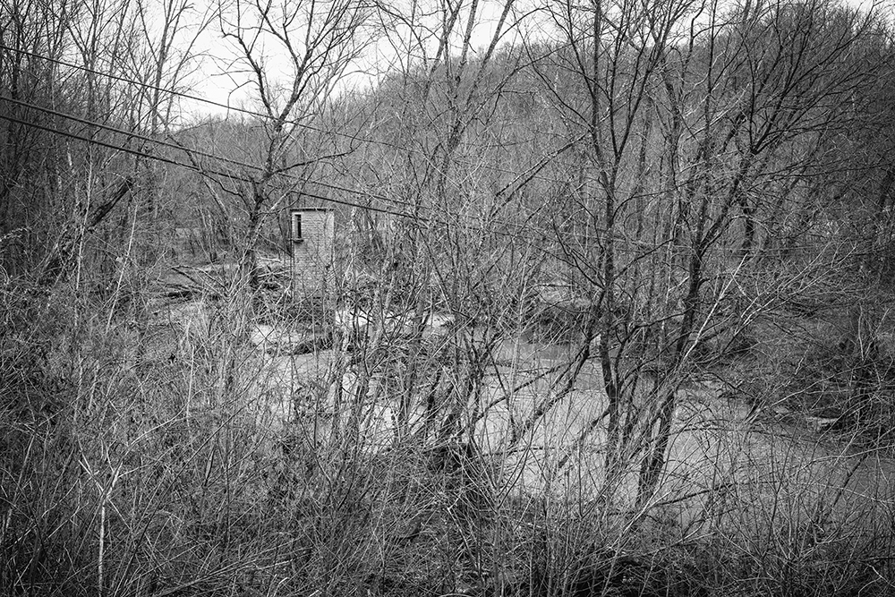
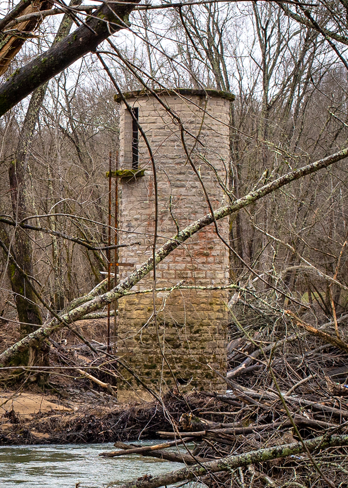
I don’t know when it was built. I’m not even sure what its really called or how it was used. I’ve always called it the water tower. It has been on the bank of the Licking River at the mouth of Long Branch longer than I’ve been walking the Earth. I’ve seen floods so high that you wonder how the tower can remain standing. Yet, every time the water recedes there it is, standing like a sentry at the entrance of West Liberty, made of that same quintessential WPA-era sandstone block you see dotting the town. Brown and weathered.
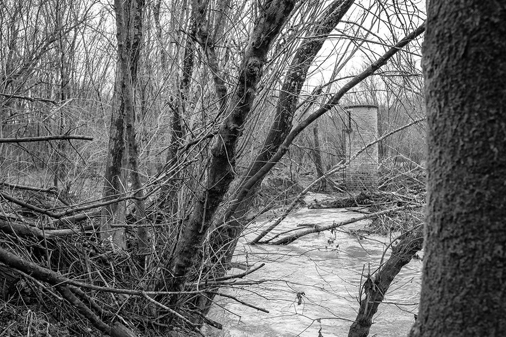
I noticed something unsettling about the water tower yesterday. I saw it as soon as we came into town. While mom was having her hair done, I took the opportunity to head to the river to get a closer look. I crawled down the bank, ducked under the bridge, and got as close to the tower as the debris would let me. Water channels naturally meander. With every high water event a new direction takes shape. Sometimes it’s human activity that causes such changes (landfill, garbage, construction, what have you), but much of the time it’s nature herself. That’s just the way things work.
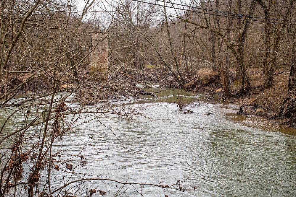
What happens when numerous storms, like the tornado that hit in 2012 both in West Liberty and upstream in Salyersville, topple a high number of large trees that then float downstream? Between that and constant logging, there are more trees in the water now than there ever were when I was a kid. Sometimes those trees gather into logjams that create enormous, sometimes dangerous changes. Such is the case with our beloved water tower. We experienced significant land loss by Aunt Janet’s house after the tornado because of all the felled trees littering Long Branch. That was just a small creek. Imagine that same impact on a river. Dozens of trees have jammed beside the water tower. The land above the jam has been cut away by the rushing waters, and the land on the downstream side of tower has been equally eroded. I would venture to guess that this new erosion has exposed 4-6 feet of the tower’s base that was under ground. How much deeper is the structure’s foundation? How much more ground loss before it begins to tip or even topple? Should the city/county take steps to shore up the little tower? West Liberty doesn’t have much remaining in the way of historic structures. Now, this one looks destined to return to dust sooner rather than later. I want to know more about its history while it’s still standing, and I hope everyone can enjoy it a little longer. Also, I’m more determined than ever to get a closer look at her.


Leave a Reply